Informujemy, że 20 czerwca 2025 Biuro Obsługi Klienta będzie nieczynne.
Przepraszamy za utrudnienia i zapraszamy do kontaktu w innym terminie.
Product description:
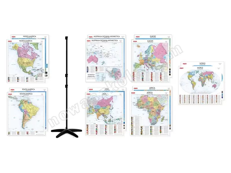
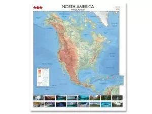
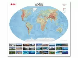
Rich collection of physical and political maps of individual continents and the whole world. Contours of the landforms are marked with colours. The maps show the current territories of countries with their capitals and the most important cities. Additionally, enriched with photographs of the most famous natural monuments with their descriptions. The political maps provide information about: flag, coat of arms, official language, capital city, political system, area, population, monetary unit converted into the zloty exchange rate, dominant religion, time zone, internet domain, codes (car, plane, telephone), GDP per person, credit assessment of the current economic situation and data on threats to personal security in public places. All maps were made of durable banner material with a handle. This set includes a map hanger made of a metal rod mounted on a stable, plastic, star-shaped base. It’s height is easily regulated (max. height: 220 cm) thanks to the telescopic tube with a lock. The hanger is easy to assemble and does not take up much space.
The set contains:
NS8331 - Africa. Physical Map - dim. 150 x 170 cm, scale - 1 : 6 500 000;
NS8332 - South America. Physical Map - dim. 150 x 170 cm, scale - 1 : 6 500 000
NS8333 North America. Physical Map - dim. 150 x 170 cm, scale 1 : 5 500 000;
NS8334 Australia, Oceania, Antarctica. Physical Map - dim. 150 x 170 cm, scale 1: 8 300 000, map scale of the Bransfield Strait area 1: 1 000 000;
NS8335 Asia. Physical Map - dim.: 150 x 170 cm, scale 1 : 7 500 000;
NS8336 Europe. Physical Map - dim. 150 x 170 cm, scale 1 : 3 500 000;
NS8337 World. Physical map - dim. 170 x 150 cm, the scale at the equator is approx.: 1: 20 000 000;
NS8341 Africa. Political Map - dim. 150 x 170 cm, scale 1 : 6 500 000;
NS8342 South America. Political Map - dim. 150 x 170 cm, scale 1 : 6 500 000;
NS8343 North America, Political Map - dim. 150 x 170 cm, scale 1 : 5 500 000;
NS8344 - Australia, Oceania, Antarctica - dim. 150 x 170 cm, scale 1: 8 300 000, map scale of the Bransfield Strait area 1: 1 000 000;
NS8345 Asia. Political Map - dim. 150 x 170 cm, scale 1 : 7 500 000;
NS8346 Europe. Political Map - dim. 150 x 170 cm, scale 1 : 3 500 000;
NS8347 World. Political Map - dim. 170 x 150 cm, the scale at the equator is approx 1: 20 000 000;
ANW600 Map Hanger.


 Polska wersja